![turfrad_logo_outlines (1)-1.svg]](https://support.turfrad.com/hubfs/turfrad_logo_outlines%20(1)-1.svg)
On the left side of the Overview tab, you’ll find the Tools.
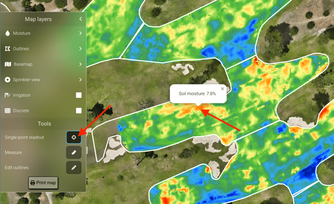
1. Single-Point Readout
This tool lets you instantly check soil moisture at any location within your scanned area. Simply click on the map to display the soil moisture percentage (Volumetric Water Content, VWC) for that exact point. Use it to quickly spot-check conditions without needing to review the entire moisture map.
2. Measure: The map measurement tool lets you measure distance and area directly in the map view. You can choose from four modes — distance, rectangle, circle, and polygon — to suit the shape you're working with. Typical uses include assessing wet or dry areas, checking sprinkler spacing, estimating hand watering zones, and planning material applications.
3. Edit outlines: With "Edit outlines", you can adjust your course map directly in the Portal. Moisture data remains visible while you edit, making it easy to align outlines with the actual fairway, green, or tee boundaries.
When you click Edit Outlines, you have to choose the area type you want to edit (e.g. Fairways, Greens, or Tees).
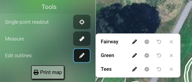
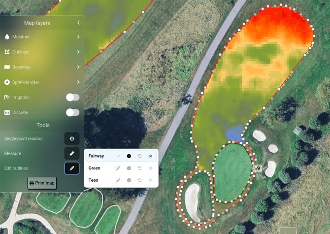
Click the Edit (✏️) icon next to the area type you want to modify. Once selected, drag the white control points to adjust the outline so it matches the actual course boundary.
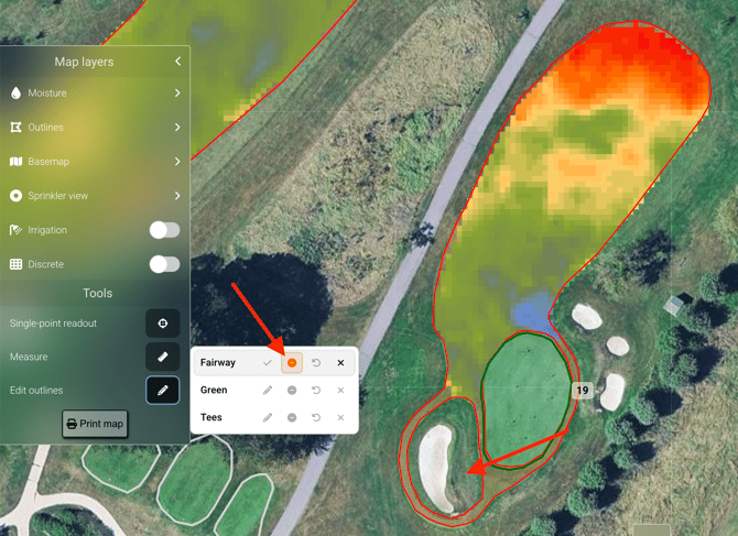
You can also remove areas from an outline, such as bunkers or other non-turf areas within a fairway. Click the Minus (-) icon, then draw a circle inside the outline to create a cut-out. Drag outward from the centre to adjust the size of the cut-out before confirming.
You can undo changes while editing — use Ctrl+Z (Windows/Linux) or Cmd+Z (Mac), or tap the back arrow button in the outline edit menu.